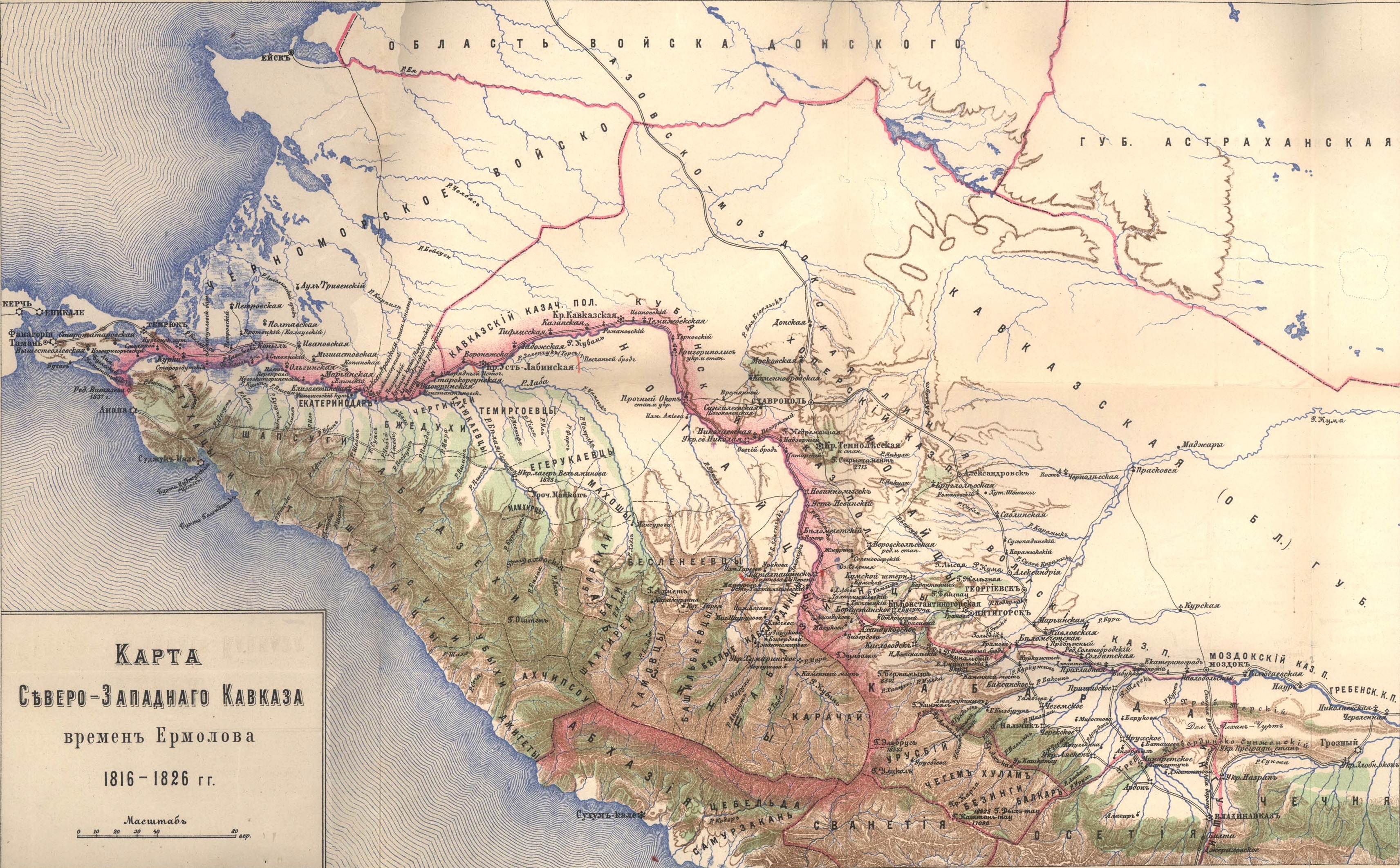
Map of Noth-West Caucasus, 1816-1826
Map of Noth-West Caucasus, at the time of Ermolov, 1816-1826. The book `The assertion of Russian rule in the Caucasus, volume 3, part 2`.
Карта Северо-западного Кавказа времён Ермолова 1816―1826 гг. Книга «Утверждение русского владычества на Кавказе», том 3, часть 2.
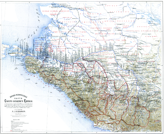
Military historical map of the Northwestern Caucasus, 1569-1774
"Military-historical map of the North-Western Caucasus" a with the location of the now non-existing fortresses, fortifications, towns, defensive and watchtowers, redoubts, feldshants, posts and the main cordon lines arranged by the Russians troops from 1569 and 1774 until the end of the Caucasian War and with indications of the time of their construction and abolition. Compiled by E.D. Felitsyn in the military history department at the headquarters of the Caucasian Military District in Tiflis in 1899. Scale: 20 versts in the English inch. Published in the book "Historical sketch of the Caucasian wars from their beginning to the annexation of Georgia".
"Военно-историческая карта Северо-Западного Кавказа" с обозначением местонахождения не существующих ныне крепостей, укреплений, городков, оборонительных и сторожевых башен, редутов, фельдшанцев, постов и главнейших кордонных линий, устроенных русскими войсками с 1569 и 1774 годов до окончания Кавказской войны и с указаниями времени их постройки и упразднения. Составлена Е.Д. Фелицыным в военно-историческом отделе при штабе Кавказского военного округа в Тифлисе в 1899 году. Масштаб: 20 верст в английском дюйме. Опубликована в книге "Исторический очерк кавказских войн от их начала до присоединения Грузии".
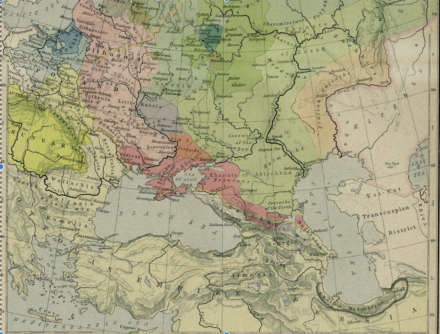
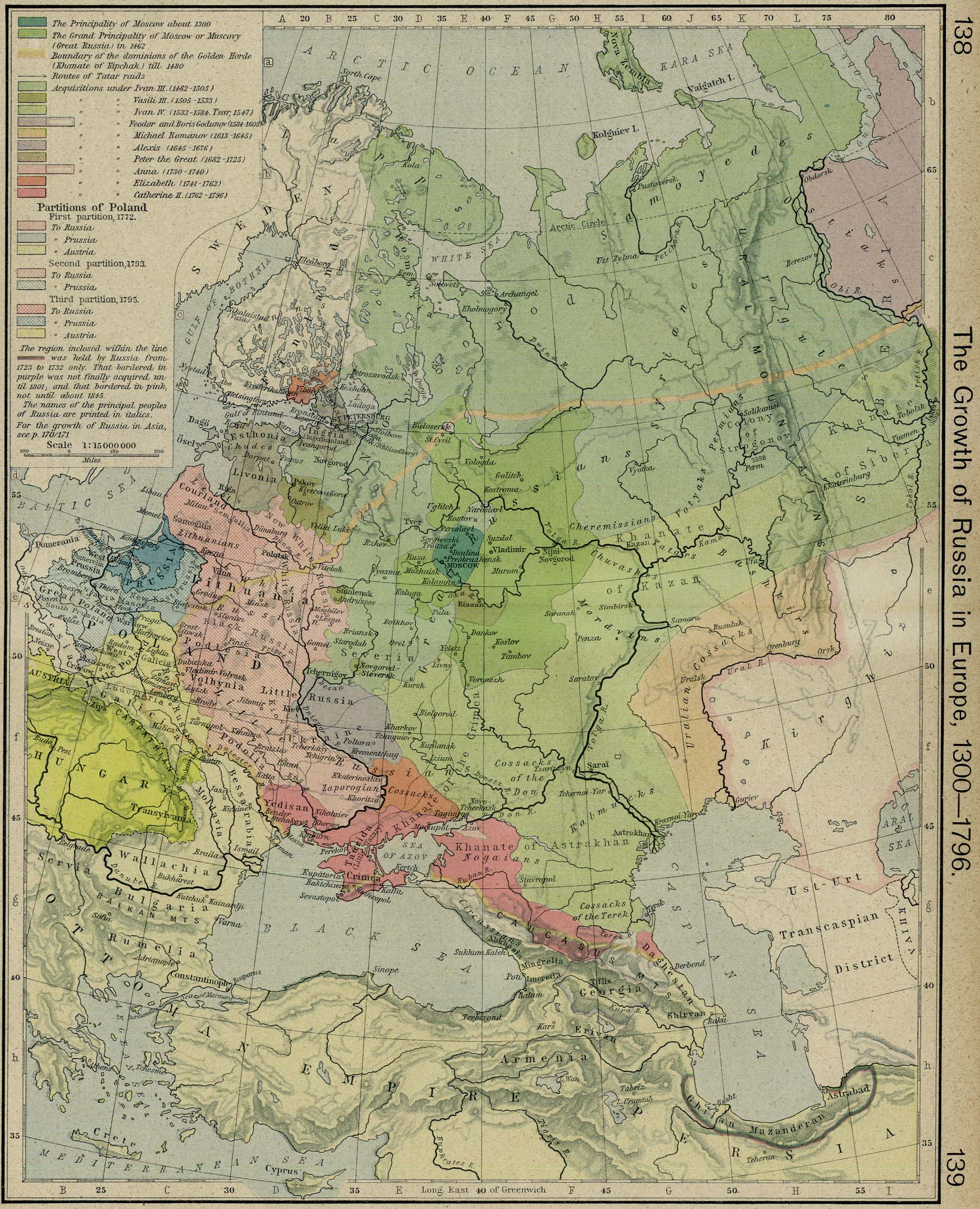
The Growth of Russia in Europe, 1300-1796
The Growth of Russia in Europe, 1300-1796. From The Historical Atlas by William R. Shepherd, 1926.
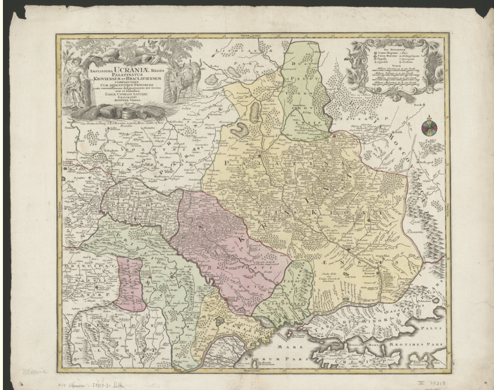
Ukrainian region 1757 by Lotter Tobias Conrad
Ukraine is the region that encompasses the voivodeships of Kyiv and Bratslav. A voivodeship is an administrative division typical of Poland, which was originally governed by a voivode or army commander. One can compare it to what we call a duchy. On this map the term is translated into Latin as Palatinatus. Both voivodeships belonged to the Polish-Lithuanian Commonwealth from 1569 (the Union of Lublin) to 1793 – although in 1668 Kyiv and left-bank Ukraine (the part of Ukraine on the east bank of the Dnieper River) were handed over to Russia under the Treaty of Andrusovo (1667).
Amplissima Ucraniae regio, palatinatus Kioviensem et Braclaviensem complectens, cum adjacentibus provinciis juxta recentissimam designationem aeri incisa : cum gratia et privil. S.R.I. vicariatus, in partib. Rheni, Sveviae, et Juris Franconici / Lotter, Tobias Conrad ; Mappothèque Vandermaelen, Philippe. – Augustae Vindel. : arte et sumtibus Tobiae Conradi Lotteri, [1757-] KBR, XIV Ukraine - (1757-) - Lotter - III 10321
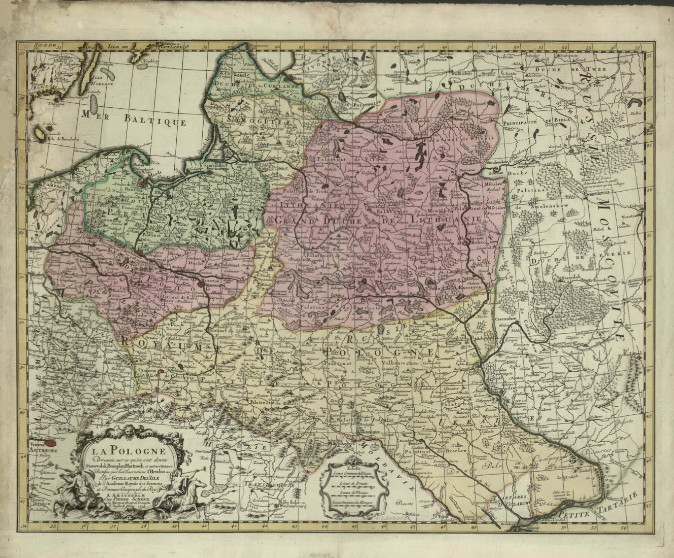
A map of the Polish-Lithuanian Commonwealth, 1734
A map of the Polish-Lithuanian Commonwealth by Guillaume Delisle, 1734
La Pologne : dressée sur ce qu'en ont donné Starovolsk, Beauplan, Hartnoch, et autres Auteurs : Rectifiee par Les Observations d'Hevelius etc.
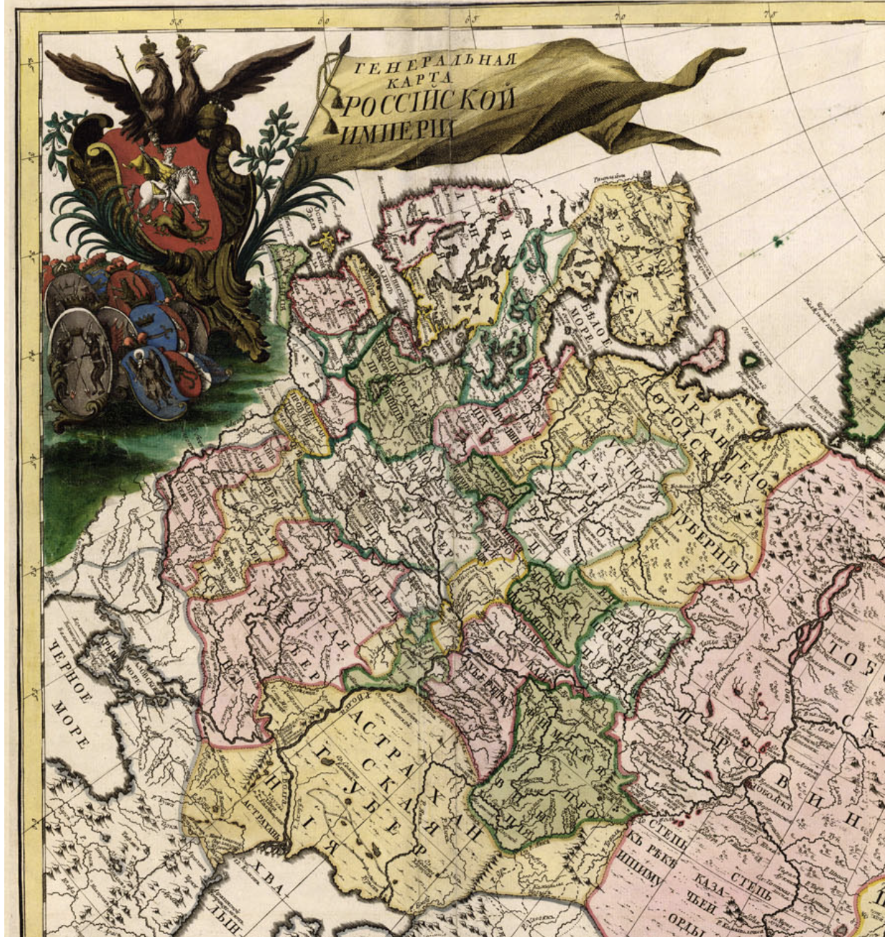
Russian Empire, 1745
Atlas of Russia, consisting of nineteen special maps representing the Russian Empire, Imperial Academy of Sciences 1745
Атлас Российской, состоящей из девятнатцати специальных карт представляющих Всероссийскую Империю с пограничными землями, сочиненной по правилам географическим и новейшим обсервациям, с приложенною при том генеральною картою великия сея империи, старанием и трудами Императорской академии наук 1745 года
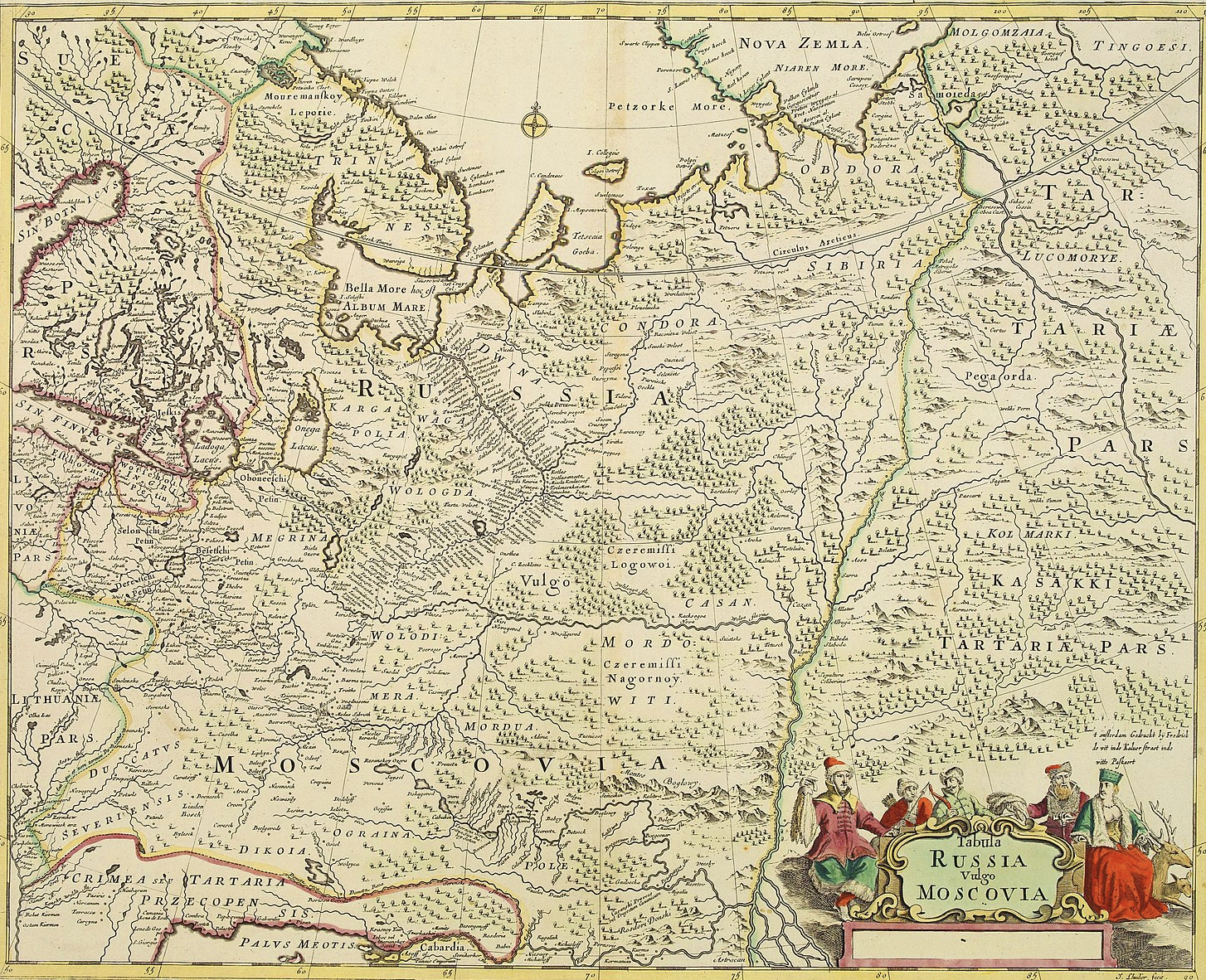
Russia vulgo Moscovia 1641
The map of Moscovia (Russian Tsardom), published in 1680 by Frederick De Wit
Tabula Russia Vulgo Moscovia
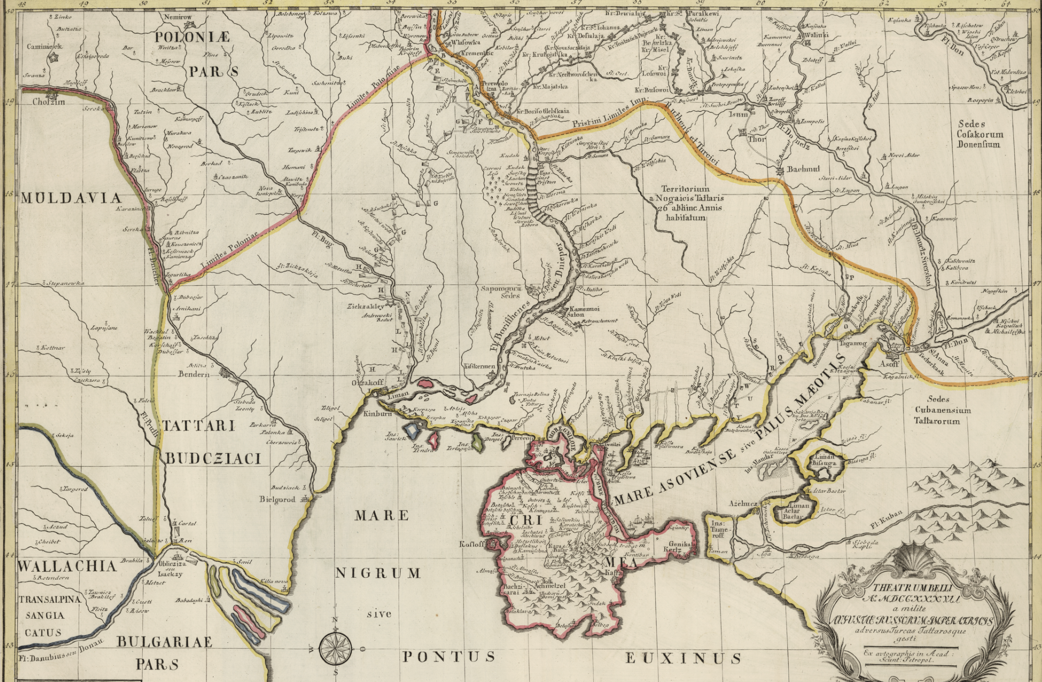
Russo-Turkish War, 1736-1739
Theater of War 1837 conducted by a soldier of Augusta, Empress of the Russians, against the Turks and Tartars. Ex. autographs in Acad: Scient: Petropol. (Compiled by Joseph Nicolas de L'Isle for the Russian Academy of Sciences in 1745. Nogai Horde, Crimean Khanate, Black Sea, Russian Tsardom, Ottoman Empire.)
Theatrum Belli Ao MDCCXXXVII. a milite Augustae Russorum Imperatricis adversus Turcas Tattarosque gesti. Ex. autographis in Acad: Scient: Petropol
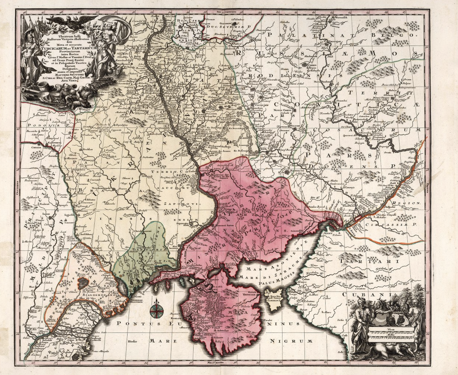
Turks and Tatars, 1740
Turks and Tatars by Mattaeus Seutter, 1740
Nova et accurata Turicicurum et Tartaricum
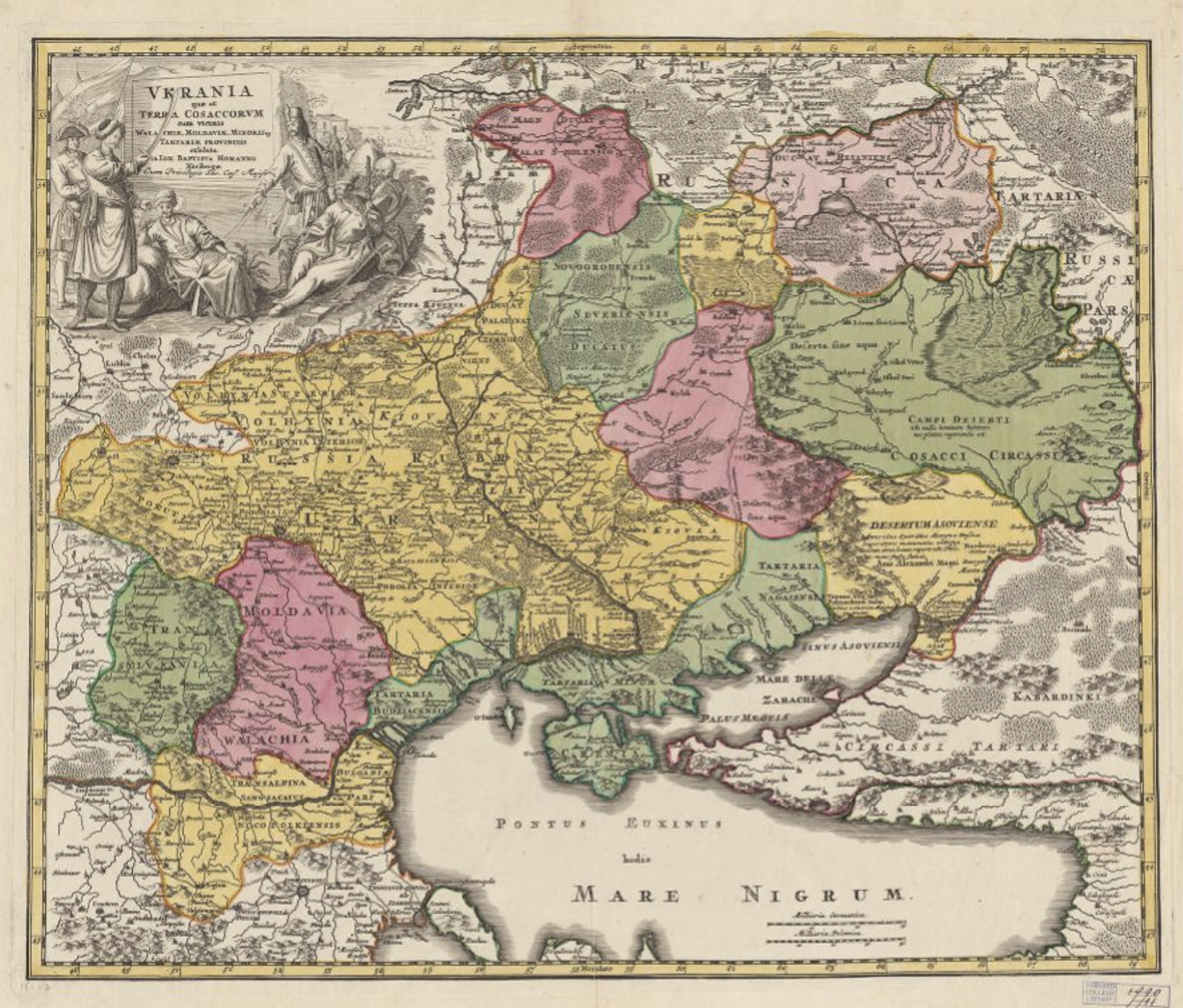
Ukraine, Cossacks, Walachia, Moldavia, Tartaria. 1735
Ukraine and the Land of the Cossacks with the Neighboring provinces of Wallachia, Moldavia, Minori, and Tartary. Presented by John Baptista Homanno. Nuremberg
Ukrania qua et Terra Cossacorum cum vicinis Walachia, Moldavia, Minoris, Tartaria provinciis exhibita. a Ioh Baptista Homanno. Noriberga
